INTO THE WOODS - HIKING AMATHOLE
Wednesday, 5th June 2019

The Amatola Mountains, surrounding the small village of Hogsback, are known for dense Afromontane forests and between ferns, forest canopies and wild orchids lie a myriad of mystical moments wrapped up in fairy tales, treasures and enchanting fantasies, a true fountain of creative inspiration.
As soon as you find yourself surrounded by green foliage, it becomes easy to understand why it is believed that Lord of the Rings author, J.R.R Tolkien, used the Amathole landscape as a muse and inspiration to create his fantasy universe, Middle Earth.
There is, of course, no better way to explore the forest than on foot, and amongst the mountains, waterfalls, ups, downs and high canopies, there are a number of epic trails to explore. So, why not leave a little space in your bag (and your heart) when you hike around the Amathole Mountains because some of that misty magic and those fascinating fairies will, without a doubt, wriggle onto your path and into your soul.
AMATHOLE MULTI-DAY HIKE
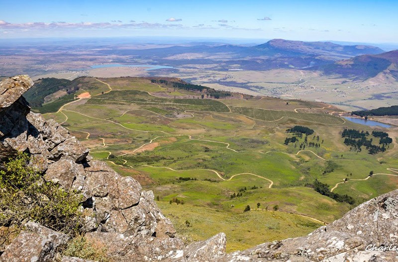
The six-day and 106km trail has been dubbed South Africa’s toughest hike, but if it’s true what they say about fitness being 90% in the mind and 10% in the body, then you’ll be filled with joy knowing that it is also one of South Africa’s most beautiful, panoramic hiking trails. Long distances, yes, but the views, tumbling waterfalls, mountain pools and serene forests are the perfect remedy for blisters and sore muscles. The trail starts at Maden Dam near King Williams Town and ends in Hogsback; the terrain is tough with plenty of inclines and declines, and the accommodation is in basic backpacker huts with bed and mattresses, showers, toilets and a fireplace. The longest day is 19.6 km (day 2) and the fourth day, from Cata to Mnyameni, is the shortest at 13.5 km; there are alternative route options on some of the days. If you’re searching for a challenging, awe-inspiring journey through this magnificent part of the Eastern Cape, this one is for you.

Image: Charley Lewis
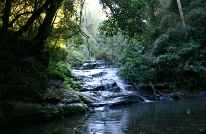
ZINGCUKA LOOP
If you want to experience a bit of the Amathole Hiking Trail but don’t want to commit to the full 106km yet, why not try the Zingcuka Loop? It is a two-day/one-night trail of 36km that starts and finishes in Hogsback. The first day will take you down into the Mnyameni Valley and the Zingcuka edge, while the second day follows the traditional final day of the Amathole Multi-Day Hike back into Hogsback.

Image: Charley Lewis
KOLOGHA FOREST TRAILS
About 80km from Hogsback, next to the small town of Stutterheim, is the Kologha Forest Reserve where three different hiking trails await avid hikers. The trails are circular routes, starting and finishing at a picnic area complete with secure parking and a place to braai. This is day-hiking at its best as the Blue Route is just 1.5km and will take you to three waterfalls, the Yellow Route is 7km and involves two waterfalls and sheltered paths to reach the higher end of the hillside and the more challenging Red Route is a total of 17km with jaw-dropping natural scenery.

Image: Stutterheim Tourism
YOU MIGHT ALSO ENJOY
BIG SKY COUNTRY - YOUR ULTIMATE GUIDE TO HIKING IN THE KAROO HEARTLAND
The 39 Steps Falls and Arboretum are a short walk (about 15 minutes from town). You’ll meander through the Arboretum amongst California redwoods and other majestic floral giants to the lovely 39 Steps Waterfall.
The Military Path is a short and comfortable walk of 2km - under an hour - perfect for young and old, and it takes you along the road that was used as a travel-shoot for British soldiers who had to find their way between Fort Hare and Fort Michel.
Enjoy the easy to moderate Bluff Trail that starts at The Edge and goes up to the Eco-Shrine of Diana Graham. The 45-minute trail is home to some awe-inspiring plants and flowers and offers spectacular views of the mountains and Tyume Valley.
The Madonna and Child Falls received its name due to the outcrop of rock on the face of the falls that resembles (with a bit of imagination) the shape of a mother and child. You can do the hike in two different ways: either via the steep downhill walk from World Ridge Road that is situated 4km from Village Green, or, for a longer walk you can access it via the Big Tree.
The Big Tree of Hogsback refers to the 800-year old yellowwood in the forest and can be reached via the Main Road. You can extend the original one-hour hike up to 5 hours by continuing with the Swallow Tail Falls, the Bridal Veil Falls and Madonna and Child Falls.

KNOW BEFORE YOU GO
It is important to keep in mind that the weather can change quickly in the Amathole Mountains; always tell someone where you are going, keep an eye on the mist as it can often lead you astray, and be surefooted when crossing waterfalls and slippery rocks. Rain is common in this area, packing a poncho won’t hurt, as well as an extra pair or two of socks, with drizzles and water crossings, you may get wet. Remember to pack light for the multi-day trails, as these trails are not slackpacking trails, you have to carry it all on your back. For more information, visit www.hogsback.com or www.stutterheimtourism.co.za