Kouga Dam - Baviaanskloof
- Baviaanskloof
About Kouga Dam
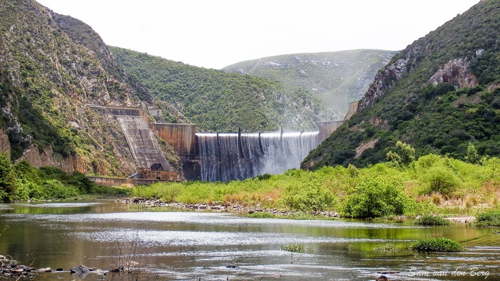
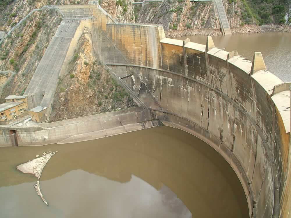


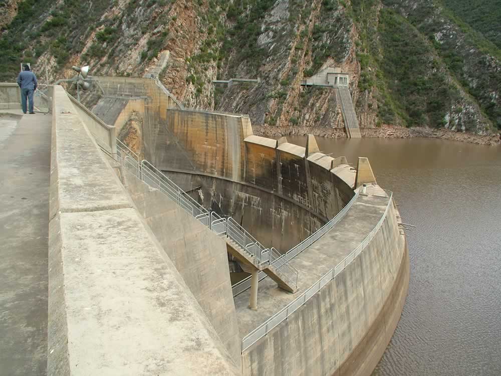

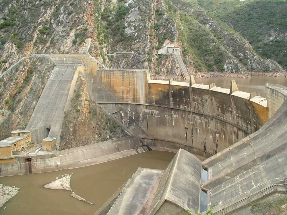


The dam is a double curvature arch dam 82 m high with a storage capacity of 128,7 million m3. Provision was made in the design to allow for a future raising of the water 1ev by some 15,2 m. The construction of the wall marked the beginning of an era of double curvature arch dams in South Africa. Besides the normal central overspill section, flood-control sluice gates with chute spillways were provided on the left flank
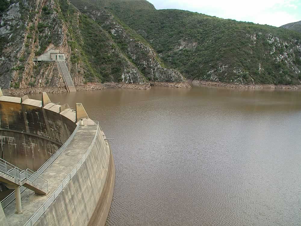
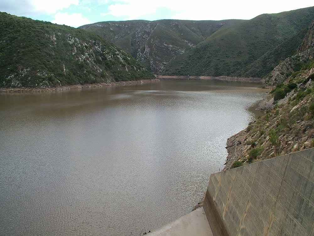
The dam has a catchment area of 388700 ha. The length of the dam basin is approximately 34 km an the surface area of the impoundment at full storage capacity is 555 ha. Geologically, the gorge within which the dam is located, comprises strata of the Table Mountain sandstone series in which layers of shale and tillite are included. As the quality of the foundation material was not very good, extensive measures for safeguarding the dam structure and its foundations were required. These measures included:
The construction of a series of tunnels in the right flank, from which a system of drainage and grout holes were drilled to prevent the development of high uplift water pressures in the rock flank
The construction of a thick reinforced concrete slab against the right flank downstream of the dam, and post-stressing thereof by means of cables penetrating to a depth of 24 to 46 m into the mountainside, to consolidate the rock mass.
Grouting under the spiliway apron A comprehensive set of observation instruments and observation points in and on the dam wall was incorporated as part of the normal monltoring procedure.
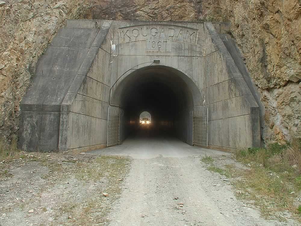
A small hydroelectric power station with three turbines of 1 200 kVA each was constructed on the right bank. This makes use of the energy available from the water discharged into the downstream canal. However, the generation of power at this station is at present not economical. Water is distributed to consumers by means of a system of canals and pipelines. The main canal starts at the dam and ends at the Loerie Balancing Dam. The canal system consists of canals, siphons, balancing dams and pipelines. The total length of the main canal is 97 km (72 km canal, 17 km siphons and 8 km tunnels). The total length of the branch canals is 30 km and the total length of the pipelines is 91 km. in addition to the Loerie Balancing Dam, a further two balancing dams were constructed along the route of the main canal to prevent the wasting of water due to fluctuations of demand. The main canal has a carrying capacity of 8,5 m3/s at the Kouga Dam. The carrying capacity decreases at each of the balancing dams until the ultimate caring capacity at the point of discharge of the canal into the loerie Dam is 3,1 m3/s.
The Loerie Dam with a capacity of 3,4 million m3 consists of an earthfill embankment with a clay core and a side channel spillway on the left flank of the dam wall. The dam also has a crest spillway which was added in 1983 after the earth embankment had been overtopped on two occasions.
PURPOSE
The Kouga Dam and the main canal supply water for both irrigation and urban use; the branch canals are used mainly for irrigation and the Loerie Dam for urban water supply only. Water is supplied to the Port Elizabeth Municipality's purification works at the Loerie Dam site by means of an outlet control tower and tunnel.
From the Kouga Dam, irrigation water is supplied by means of the canal and pipeline system to 7400 ha of scheduled ground. Every irrigator is supplied with at least one draw-off with a selfregistertng meter, which he himself can operate according to his needs, up to a mamum Iimit of 8000 m3 per ha per year.
The Kouga Dam was also built to serve as a flood-control dam for floods originating from the catchment area of the Kouga Rtver and to decrease the effects of these floods in the lower Gamtoos area.
ENVIRONMENT
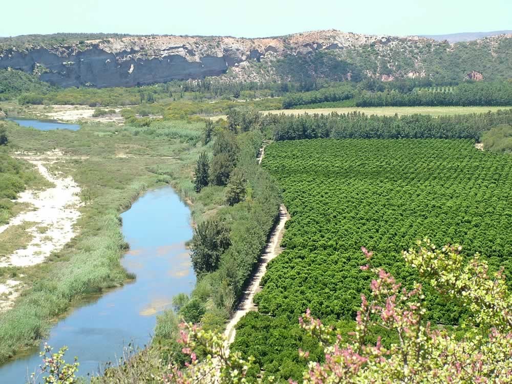
Gamtoos Valley downstream of the dam, consists of alluvial deposits of the Ultenhage Series composed of round pebbles, shales and clays, forming near-vertical cliffs of conglomerate. Typical vegetation up against the slopes consists of succulents such as elephant's food, candelabra trees and aloes forming dense, Impenetrable thickets. Dense thorn-trees, yellow wood, wild olive, sneeze-wood, wild fig and many other trees and tall bush grow on the plains and along the beds of the tributaries.
MORE INFORMATION